|
To reach the famous shrine of Kuys (virgin) Varvara, go uphill
through village (mudholes). At
17.4 km keep straight at fork in road.
At 17.7 km bear right at 3-
way fork (asphalt). At 18.4 km continue past the factory (on
right), orchards. At
24.2 km turn right at T (by pump station-going left takes you
through a Yezidi hamlet to an impassible track up the back side of
the mountain). At 24.4 km turn left over canal onto rocky jeep track (going
straight leads eventually to Yeghvard).
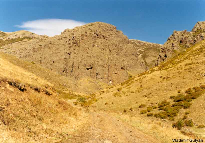
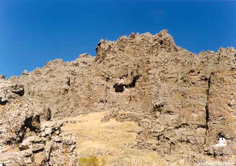
Ascend along a gully approximately 1.5 km, or a 30-minute uphill
walk into the heavily eroded and mysterious volcanic crater of Mt.
Ara, named after the handsome early Armenian god/hero/king
killed and brought back to life under mythological circumstances
involving Queen Semiramis (but less elegantly called in Perso-Russian
times Garniyarigh - "Torn Stomach" in Turkish).
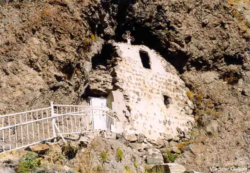
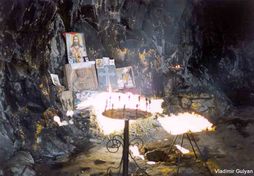
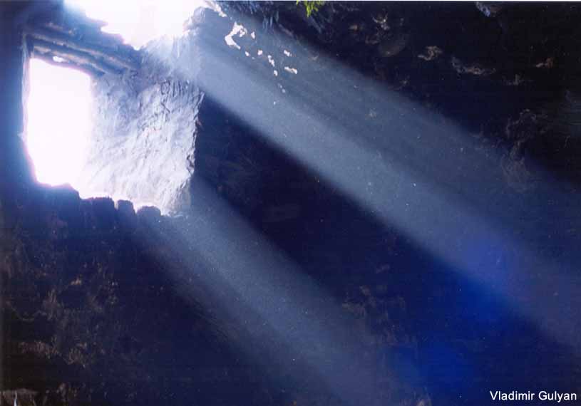
Built into a mossy cave, complete with sacred spring, is
the shrine of Kuys Varvara (the Virgin Barbara), also known as Tsaghkevank, with
saint’s tomb, altar, ferns, and candle vendors. The Vatican has decided that St. Barbara, like St. Christopher,
is probably mythical, but if she did exist she was martyred by
her cruel father for espousing Christianity, or alternatively
snatched away by angels. Local
holy person will say prayers and help you nick the comb or ear of
rooster or sheep before you sacrifice it down below in gratitude
for anticipation of the saint’s healing intercession.
Picnic tables available.
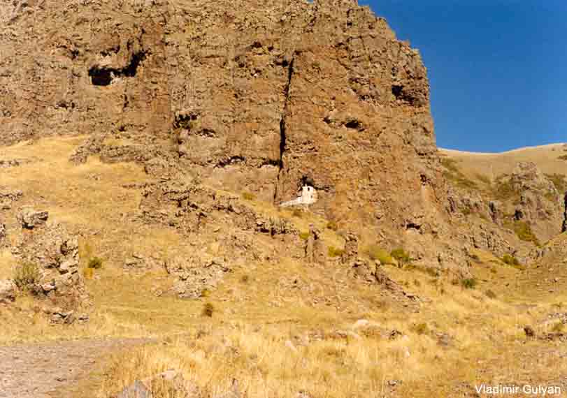
In the gorge leading into the crater are house and
fortification walls. Further
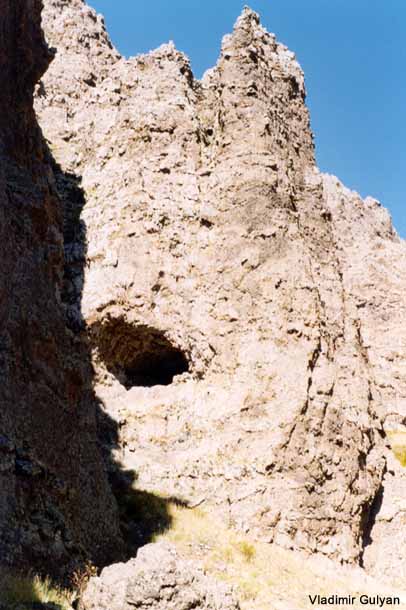
up the crater to the right of the shrine is another small cave
with a cross and some pictures of the saint.
To the left of the shrine, along a narrow path, are faint
traces of a medieval building. There is at least one bear roaming
the mountain, and two snakes; also, other caves, rock formations,
and a strenuous but scenic hike around the crater rim (ca. 3
hours; the trail up, like St. Barbara herself, existentially
challenged).
|