|
UNDER
CONSTRUCTION
|
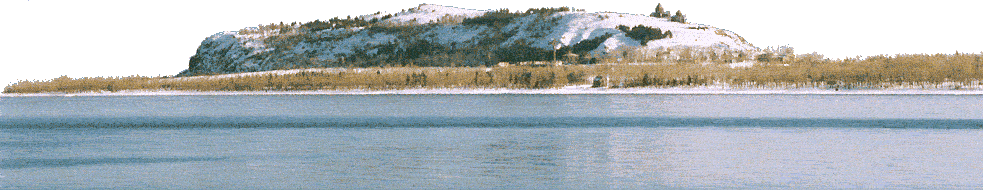
Martuni,
anciently Mets Kznut, from 1830-1922 Nerkin Gharanlugh, from
1926 Martuni, former rayon capital, named for first Soviet PM
Myasnikian’s nom de guerre.
It has various non-functioning industries and
“Martuni” Rest House.
Astvatsatsin church rebuilt in 1886; on the S edge of
Martuni left of the
Martuni-Geghhovit |
|
S
from Martuni on the road
that, in good weather in a sturdy car, leads to the Selim
Caravansaray and Yeghegnadzor, one first reaches
Geghhovit
(till 1968 Verin Gharanlugh; founded in the 15th
c., but current residents from Alashkert in 1823).
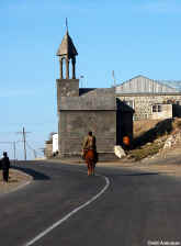
In the village is a S. Gevorg
church.
The small modern
cement
|
|
|
road
are cyclopean fort ruins above the modern cemetery.
|
|
Tukh
Manuk shrine just on the S end of town was erected by the local member of
parliament, perhaps for electoral purposes.
There is a small cyclopean fort on the hill above.
In the middle of the village, a road descends SW and
crosses the river.
Turning left at the first opportunity after the river,
you reach a hilltop just S of the village with walls of an Iron
Age fort (best seen at S end) excavated in 1997 by an
Armenian-Italian team.
Supposedly the medieval Alberd fort, mentioned in
connection with a 9th c. Byzantine military campaign,
is here as well, with a shrine of S. Mamas.
About 4 km S of Geghhovit, on a hill E of the road where
the Martuni and Dashtidzor rivers come together, is a Berdi
Glukh cyclopean fort. |