|
Another
few km uphill past Baiburt, on a poor jeep track, is the
hamlet of Mets Gilanlar, with a few simple wooden huts.
Turning left just before Gilanlar, the road continues to a
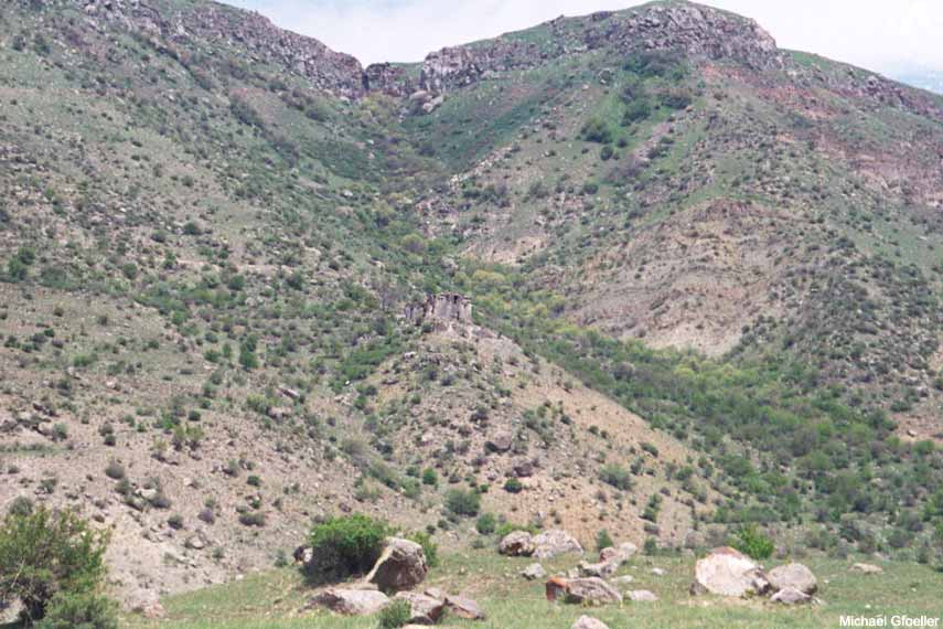
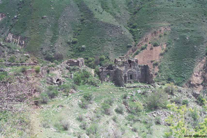
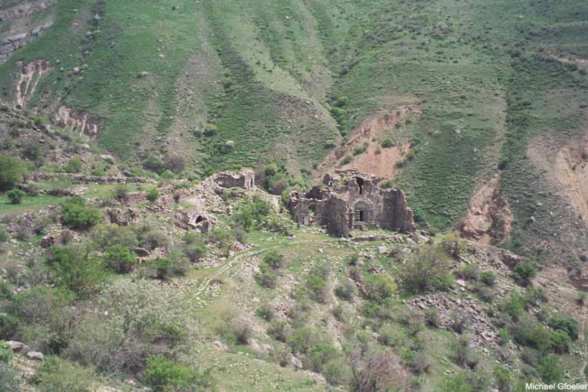
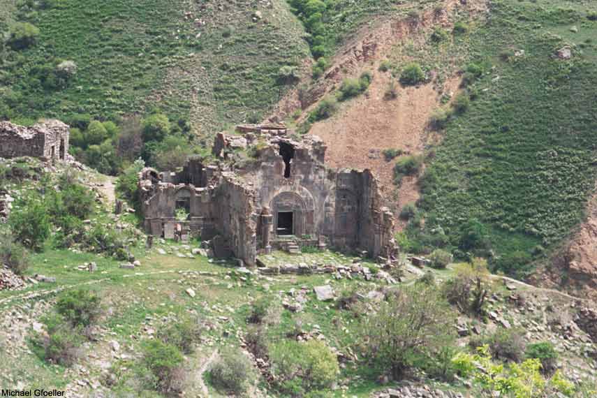
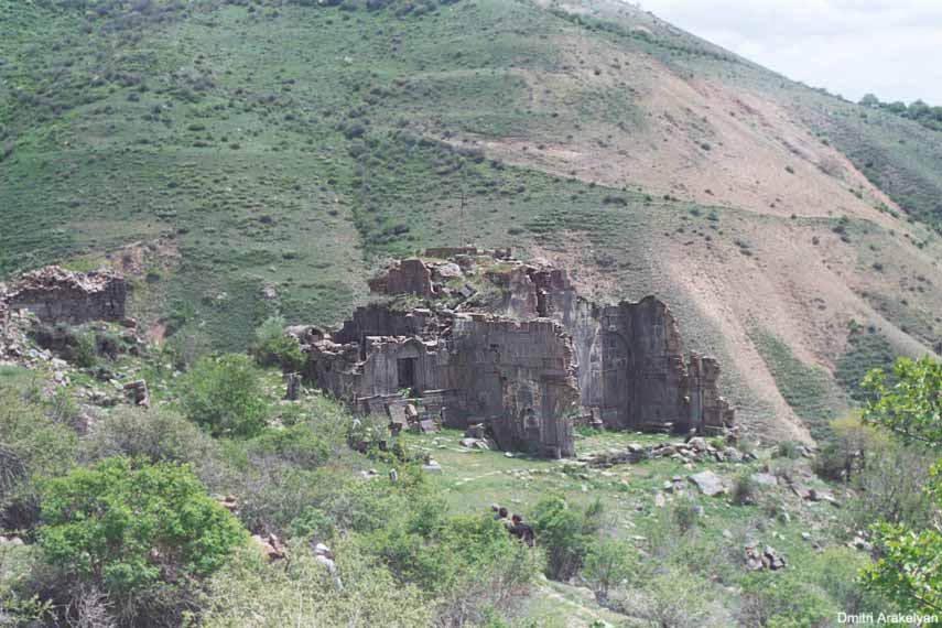
valley across which (20 minutes on foot) are the evocative ruins
of the Aghjots Vank/S.
Stepanos Church of the early 13th century (though
founded, according to local legend, by Gregory the Illuminator on
the site of the martyrdom of a certain Stepanos, companion of St.
Hripsime).
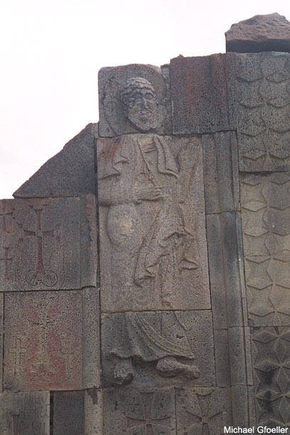
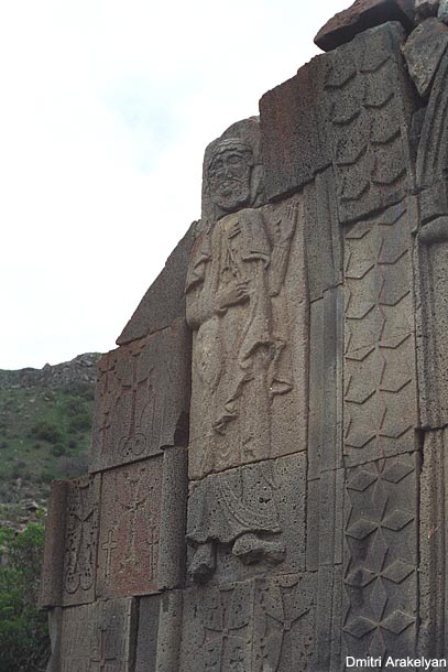
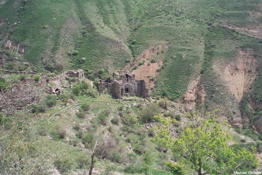
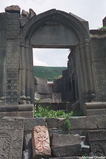
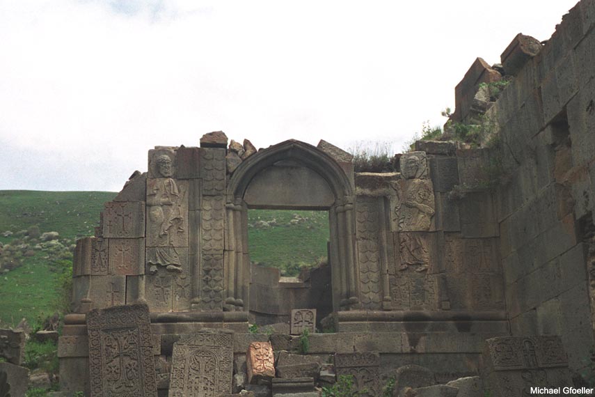
Added to the W end of the church of 1207, funded by Ivane
Zakarian and the local prince Grigor Khaghbakian, is a gavit
with many inscriptions and khachkars, now partly fallen down the
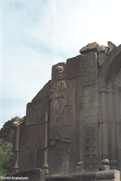
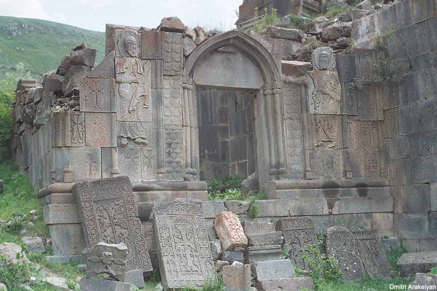
hill, and N is a small chapel of 1270 with
with a carved portal flanked by Saints Peter (left) and Paul
(bearded, right).
The monastery was sacked by the Persians in 1603,
subsequently restored, despoiled again in the 18th
century, and ruined permanently in Muslim-Christian clashes in
1905/6.
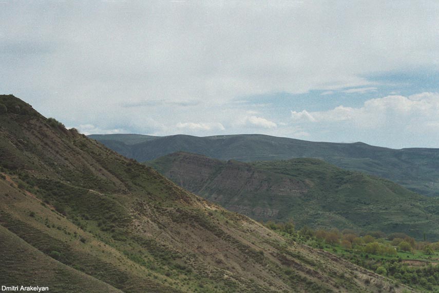
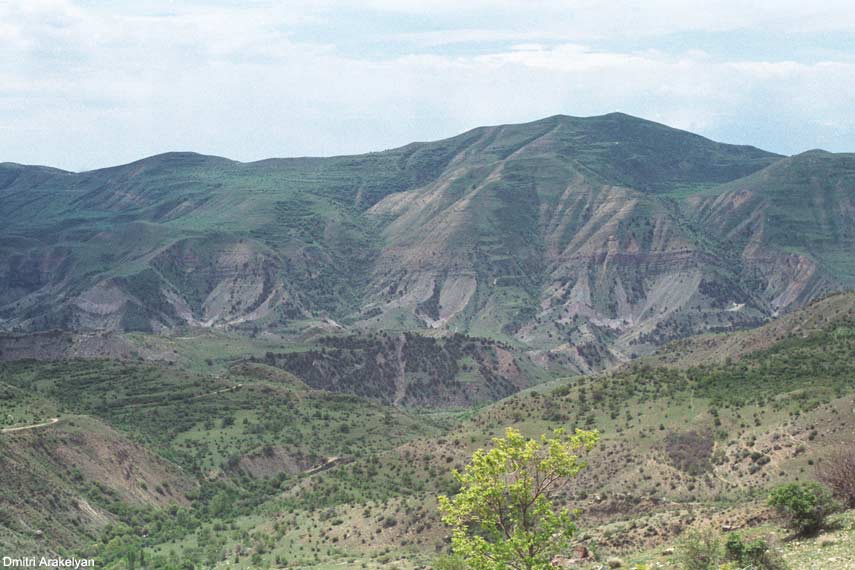
S. Stepanos can also be reached on foot or horse (and, in
good weather, maybe Jeep) from Goght, about 3 hours of stiff but
highly rewarding climb. From
Goght, a jeep/mule track descends into the gorge, crosses, and
climbs up and over to reach S. Stepanos monastery.
Driving into Goght on the paved road, turn left on the dirt
road just before the paved square.
After 200 meters, the right fork descends E into the gorge,
fords the stream, and rises steeply up to the top of the ridge.
On foot from Goght, following the jeep track, you reach in
about an hour the ruined hamlet of Almardan (left of track a
little khachkar beside a ruined apsidal church?), then slope up W
to the summit (another hour).
The right fork leads around the slope, descending to the
ruined hamlet of Ellija, and continues E, passing just above S.
Stepanos before ending in a series of particularly bad goat
tracks.
The left fork follows the crest of the ridge E into the
deep mountains.
Note that the track is steep and likely to be covered
during wet weather in very greasy mud.
There is also a mule-track that ascends the ridge more
directly, starting from the same point at the bottom of the gorge
but bearing off to the W
after reaching a lower saddle W of the jeep track, take the
left downhill fork following the contour, and then take the jeep
track downhill.
|